Augmented-Reality and Tourism
Authors: Tian Xia, Kai Huang
⭐️ Featured in UCalgary Computer Science Showcase 2021
📝 Detailed report in PDF
Abstract
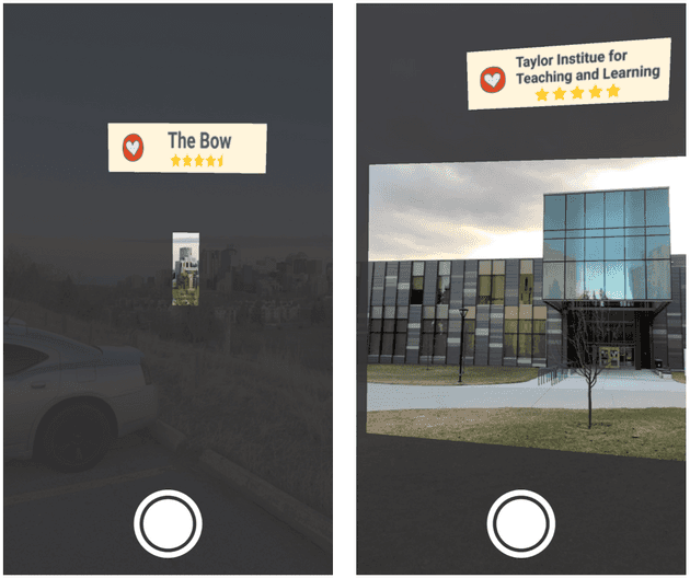
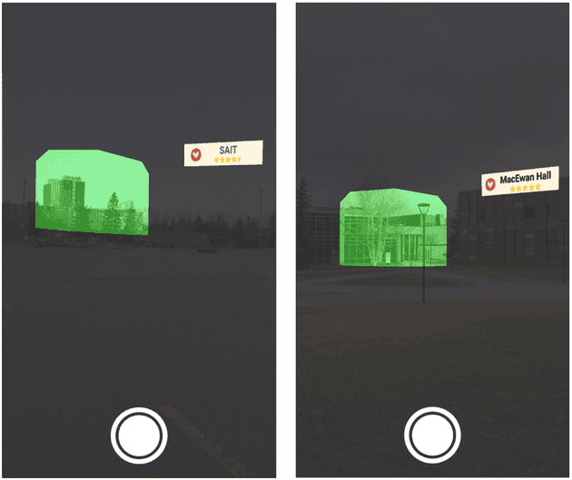
When people visit new places and need information about such places, they must search on multiple platforms to obtain business information, Google ratings, GPS navigation, etc. TourAR addresses this issue by displaying multiple sources of information in one application. TourAR is an augmented reality application built with WebXR frameworks to improve user experience in tourism. It provides users with features: 1) displaying target locations’ names and Google ratings as labels floating or attached to the target locations based on their geolocations; 2) highlighting target locations by dimming the background and displaying the target locations with green highlight or normal lighting; 3) summoning a virtual tour guide to commentate on the target locations; 4) navigating to a target location. Furthermore, we conducted user studies to improve the design and user experience of TourAR.
Feature 1 – Labels
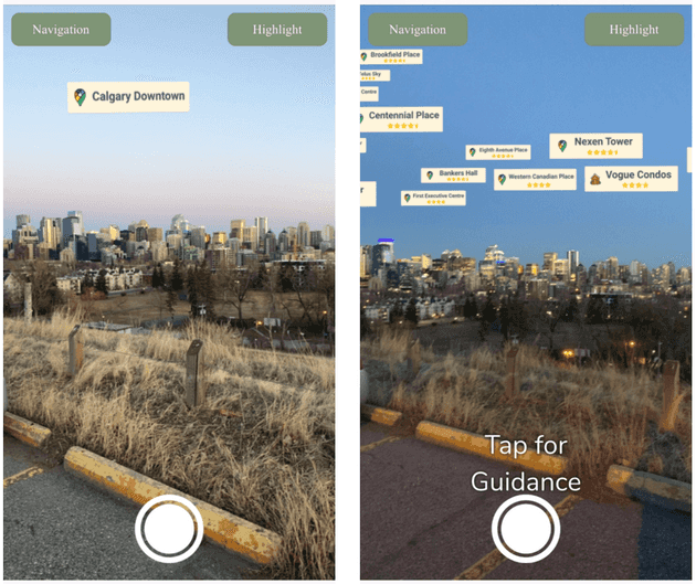
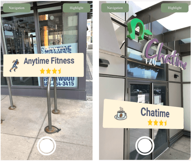
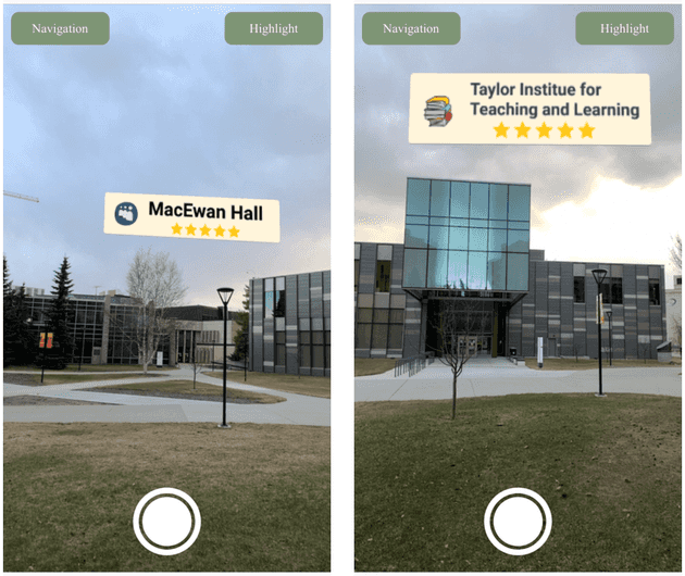
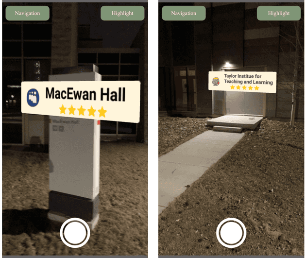
Based on the user study, we made two types of labels, floating labels and attached labels, in three types of areas based on the user’s current location and geofences we implemented, open area, populated area, and hybrid area. Floating labels are labels positioned based on their GPS coordinates shared by their physical counterparts, such as buildings as the target locations in the real world, so these labels visually appear to be floating over the target locations. Attached labels are labels positioned on a surface of the target locations, such as signs, windows, and doors, so these labels visually appear to be attached to the target locations.
Open area
An open area is an area with lots of surrounding open space, such as parks and parking lots. There is less interference for GPS signal due to the lack of obstruction from high-rise buildings, and the user tends to be far from the target locations; therefore, this is the best environment for floating labels. Since most of the areas are open areas, there is no geofencing for open areas.
Populated area
A populated area is an area surrounded by high-rise buildings, such as downtown districts and apartment complexes. There is more interference for GPS signal due to the surrounding high-rise buildings, and the user tends to be close to the target locations; therefore, this is the best environment for attached labels. Geofencing is implemented for areas surrounded by high-rise buildings.
Hybrid Area
A hybrid area is an area surrounded by some open space and some high-rise buildings, such as university campuses. There is more interference for GPS signal near the buildings and less interference in the open space, and the user can be close or far from the target locations; therefore, floating labels are displayed when the user is far from the buildings, and attached labels are displayed when the user is close to the buildings. Geofences are implemented for both open space and buildings’ surrounding areas within the hybrid areas. When the user is in the open space of the hybrid area, floating labels are displayed; when the user is near the buildings of the hybrid area, attached labels are displayed based on object tracking.
Feature 2 – Highlight
When the highlight button is toggled on, the background of the camera feed is dimmed from the addition and colour adjustment of
Feature 3 – Tour guide
“Tap for guidance” is displayed on the lower half of the screen to remind the user of the option to summon a virtual tour guide to commentate on the target location. The user can tap on the screen to summon a virtual tour guide on the ground, which corresponds to the location on the screen. Ideally, the virtual tour guide can provide guidance with customized voices and gestures based on the target locations. Due to the time constraint, a .hcap 3D model from 8th Wall is used for this prototype.
Feature 4 – Navigation
When the navigation button is toggled, a dotted line is displayed on the ground leading to the target location. The dotted line consists of many small 3D arrows as “dots” pointing at the target location. A floating label is displayed at the target location. At the same time, the highlight button can also be toggled to highlight the target location with a green layer.
📝 Detailed report in PDF
⭐️ Featured in UCalgary Computer Science Showcase 2021
